🛰️ Beijing OMap · Satellite imagery specialists

High-Resolution Satellite Imagery: Search & Purchase

From 0.3 m very-high-resolution scenes to 10 m wide-area coverage, we help you find the right image, confirm availability and deliver it ready for GIS, evidence, planning or presentation.

Fig. 1 — A satellite capturing imagery
🔎0.3–10 mresolution range
🗓️1960s–todayarchive coverage
💴¥500–6,000typical price per image
🚚5–10 daysstandard delivery
Profile

01About Beijing OMap

Beijing OMap Geographic Information Technology Co., Ltd. is a well-known satellite mapping service provider headquartered in Chaoyang District, Beijing. We specialise in Chinese remote-sensing imagery at 1–3 m resolution, including historical imagery from the 1960s–1980s and the Chinese Gaofen series from 2015 onward.

Imagery is licensed by area or scene. Chinese imagery ranges from CNY 1–30 per km², with a typical image costing CNY 500–3,000. The final price depends on area, resolution, acquisition date, product type and processing. For higher-resolution requirements, expect about CNY 100–500 per km².

Satellite imagery is a special digital product: individuals, companies and public institutions can all purchase it. We provide a formal procurement contract and invoice. Standard delivery is 5–10 working days; rush orders can be delivered the same day.

Value-added services: wall-map production, automatic land-cover classification, bare-soil monitoring, 3D white models, building recognition and vector extraction, change comparison, dispute-evidence layout, place-name labelling, landscape beautification and HD super-resolution enhancement.

To discuss coverage or place an order, contact our team or leave an online message. Use image search to browse more projects and sample maps.

📊 Indicative price by resolution

Typical order value per image · CNY / image
Prices are indicative and depend on area, acquisition date, product type and processing. Higher-resolution custom coverage is quoted per km².

✨ Value-added services

🧭 From inquiry to delivery

  1. Share your areaCity, coordinates or vector boundary
  2. Receive a quoteCoverage, date and price confirmed
  3. Contract & paymentFormal contract and invoice
  4. Production & QAProcessing, mosaicking and checks
  5. Delivery5–10 working days; rush available
Samples

02Satellite Image Samples

Click any image to open the full sample in a new tab. All prices are approximate and shown in Chinese yuan.

💡 Indicative prices only. Final quotes depend on area, date, product type and processing.

Constellation

03Common Satellite Resources

A broad portfolio of optical, radar and hyperspectral sensors — from 0.3 m very-high-resolution imagery to 48 m hyperspectral coverage.

🇨🇳
13Chinese systems
🌍
13international systems
📏
0.3–48 mresolution span
🛰️
3sensor families
Optical, radar and hyperspectral sensors: one portfolio for different mapping needs.
04 · Applications

Satellite Map Application Examples

From monitoring and AI extraction to print-ready maps and 3D scenes.

4.1

High-Frequency Satellite Monitoring

  • Sentinel-2 and other 10 m sensors support frequent revisit over large areas.
  • Track water quality, crop growth and urban expansion with consistent time series.
  • Ideal for environmental, agricultural and municipal teams that need regular updates.
Water-quality monitoring — Beijing OMap satellite imagery

Water-quality monitoring

Agricultural monitoring — Beijing OMap satellite imagery

Agricultural monitoring

Urban monitoring — Beijing OMap satellite imagery

Urban monitoring

4.2

Hyperspectral Analysis

  • Derive NDVI, NDWI and false-colour composites from 10 m Sentinel-2 imagery.
  • Reveal crop health, vegetation stress and water boundaries beyond true colour.
NDVI Crop-health map (NDVI) — Beijing OMap satellite imagery

Crop-health map (NDVI)

FCI False-colour vegetation (FCI) — Beijing OMap satellite imagery

False-colour vegetation (FCI)

NDWI Water analysis (NDWI) — Beijing OMap satellite imagery

Water analysis (NDWI)

4.3

Bare Soil & Construction Monitoring

  • Based on 0.5–1 m imagery, purchased from us or supplied by your team.
  • Monitor construction sites, exposed soil, vacant land and dust-risk areas.
  • Used by environmental, housing, construction and real-estate teams.
4.4

Automatic Vegetation Extraction

  • Works with 0.5–10 m imagery, purchased or client-supplied.
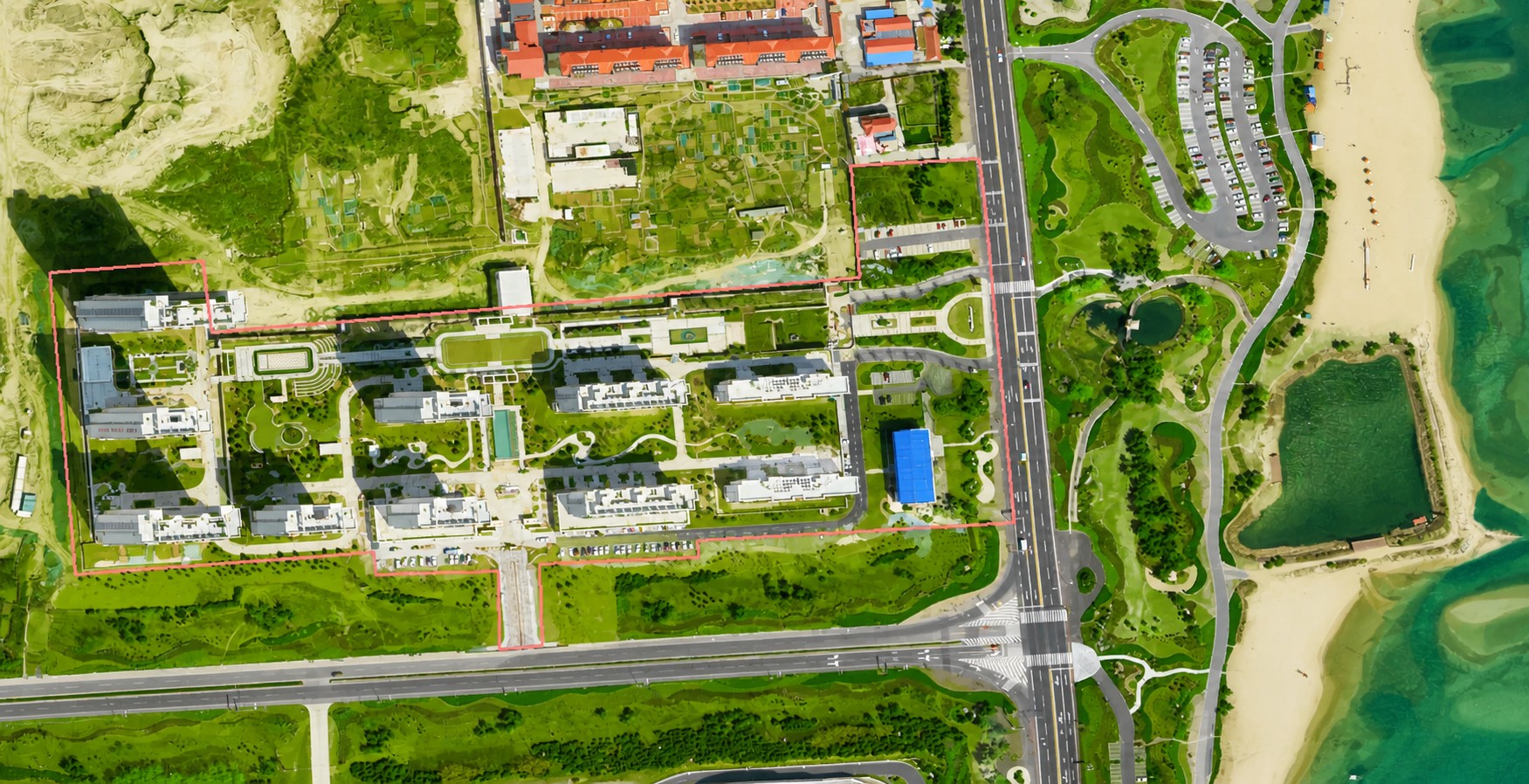
  • AI-assisted interpretation maps urban greenery and calculates green coverage.
  • Delivered as shapefile vectors for area measurement in GIS.
  • Fast and cost-effective — production can start before payment.
4.5

Land-Use Classification

  • Works with 0.5–10 m imagery.
  • AI-assisted mapping for rapid, large-area land-use classification.
  • Shapefile output includes class names and supports GIS area measurement.
  • Fast, low-cost and available on a produce-first, pay-later basis.
4.6

Automatic Building Recognition

  • Based on 0.5–1 m imagery.
  • AI extracts visible buildings across the target area.
  • Shapefile output includes building types and supports area measurement.
  • Fast, low-cost and available on a produce-first, pay-later basis.
4.7

Wall-Map Production

  • Based on 0.5–2 m imagery (imagery licensed separately).
  • Custom wall maps with place names, road names and cartographic elements.
  • For agencies with managed areas: police, fire, urban management, parks and scenic sites.
4.8

3D White Models

  • Based on 0.5–2 m imagery (imagery licensed separately).
  • 3D white models of buildings, power towers and wind turbines.
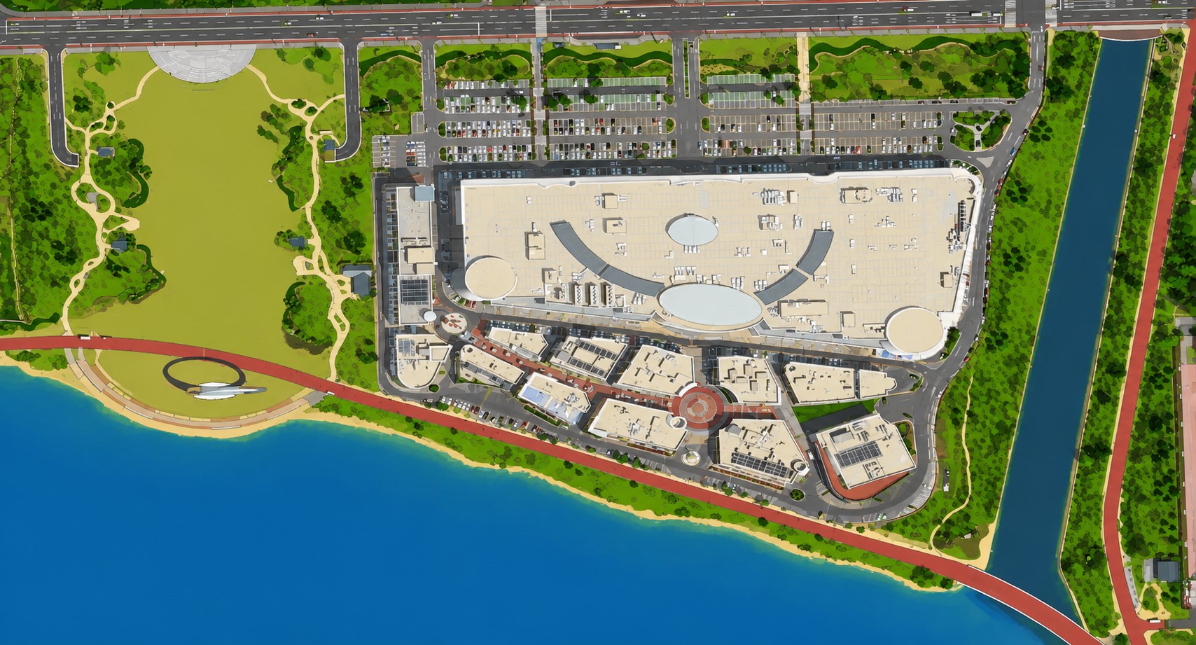
  • Buildings are colour-filled; height is estimated from shadow length.
  • Towers and turbines use standard models; view via video or GIS software.
  • For real estate, scenic areas, parks, police and fire teams.
4.9

HD Super-Resolution

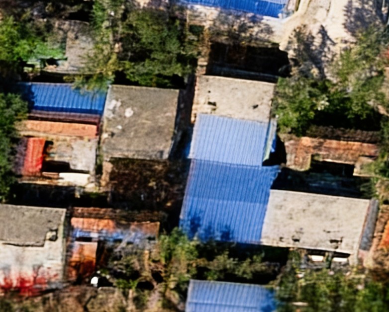
  • Definition: HD super-resolution uses deep learning to learn the relationship between low- and high-resolution images, then reconstructs texture, edges and spatial structure.
  • Goal: make roads, buildings, farmland, water and forest boundaries easier to identify.
  • Solves: blurred edges, missing texture and insufficient detail.
  • Method: AI models understand land-cover structure and image semantics while preserving the original scene.
  • Purpose: combine multi-scale feature extraction, denoising, edge enhancement and super-resolution reconstruction to improve clarity and recognizability.
  • Result: sharper boundaries, richer texture and more legible local detail.
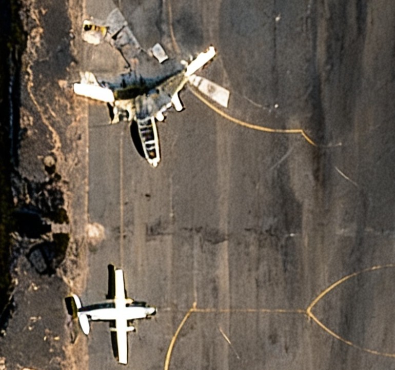
  • Best for: visual enhancement and target screening where mild distortion is acceptable.
  • Principle: “real enhancement”, not free invention; output is constrained to the original image.
  • Warning: AI detail can still be partly synthetic. Use for reference only — not as legal or evidentiary proof.
4.10

Residential & Park Landscape Maps

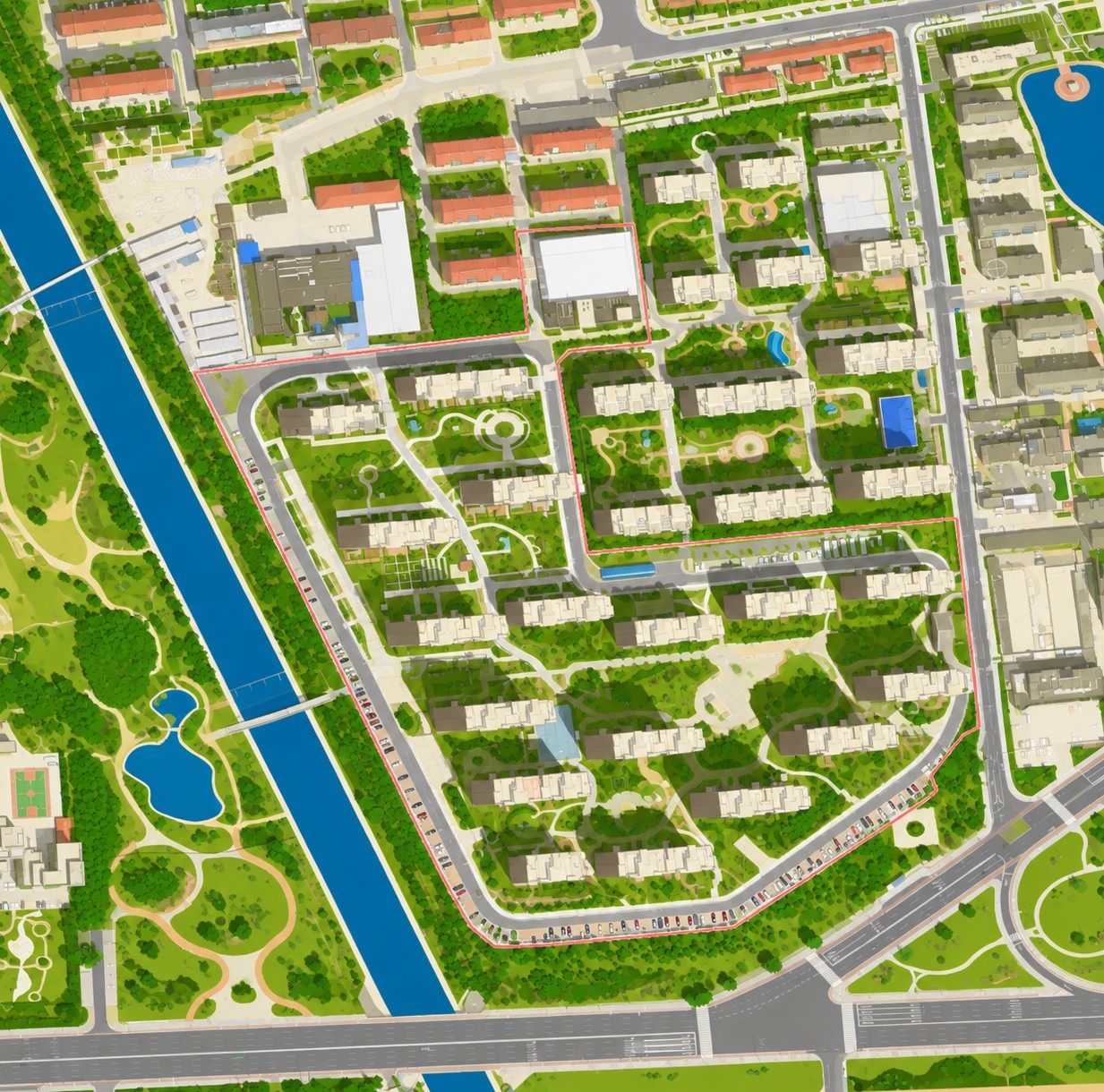
  • Produced from 0.3–2 m satellite imagery.
  • Guide maps and landscape maps for residential developments, parks, scenic areas and business parks.
  • For estate developers, agents, property managers, schools, tourism bureaus and park authorities.
Quote

05Online Inquiry & Order

Tell us the area, date and resolution you need. We will confirm coverage and price.

💡 Imagery is custom-produced. Inquiries are free; purchase is paid. Rush delivery can be same-day.